
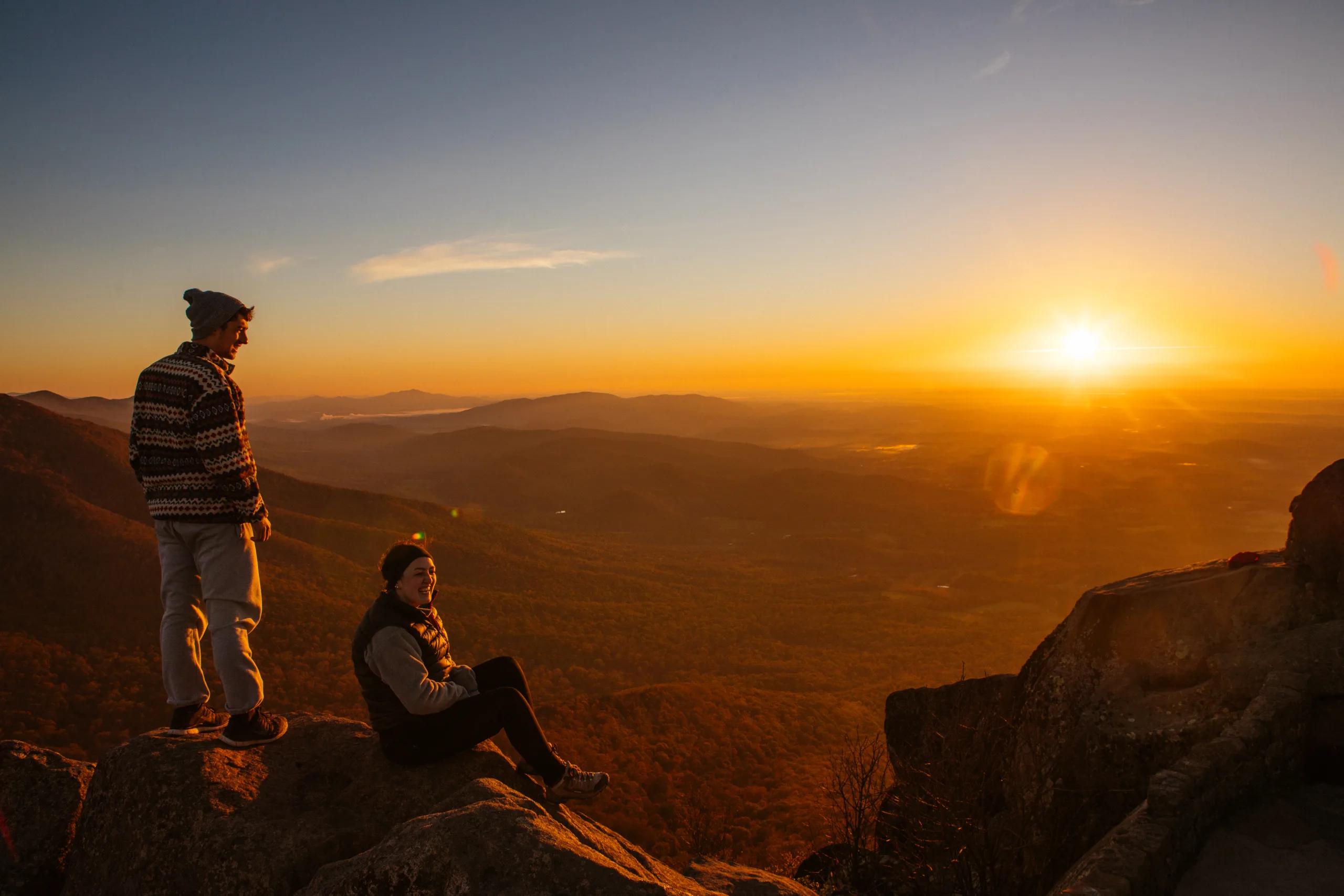
Franklin D. Roosevelt kicked off one of the most ambitious feats of landscape engineering ever undertaken when he green-lighted a 469-mile scenic byway that would trace the spine of the Blue Ridge from the Shenandoah Valley to Great Smoky Mountains National Park in 1933.
Most highways are built to ferry travelers from point to point swiftly and efficiently—but the Blue Ridge Parkway (BRP) was designed to showcase lavish, high-elevation views from a seemingly endless string of roadside overlooks. What’s more, vistas would be protected by broad swaths of public lands that stretched for about 100 acres from either side of the road.
“That goal was absolutely unique and unprecedented in scope,” says Anne Mitchell Whisnant, Duke University public history professor and author of Super-Scenic Motorway: A Blue Ridge Parkway History (The University of North Carolina Press, 2010). “And it led to what may be the most incredible collaboration between landscape architects and civil engineers in U.S. history.”
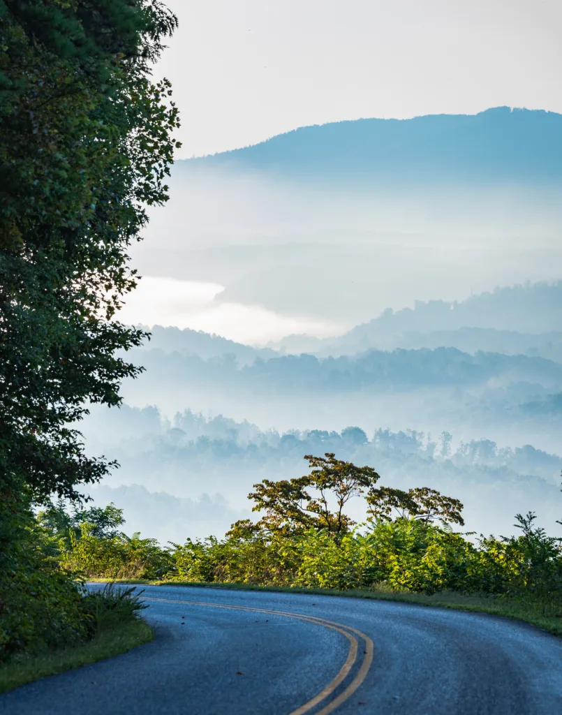
The results were groundbreaking. Innovative planners borrowed from railways to create gently sweeping “transition” curves that hugged the mountainside, enabling motorists to maintain steady cruising speeds. Structures like concrete bridges and roadway supports were made from, or faced with, native stone to blend into the natural environment and create a historic aura. Four teams of 200 Civil Conservation Corps employees were recruited to build the roadway, clear overlooks, and blaze trails to roadside summits and other natural points of interest. Ample access points, meanwhile, connected the route to amenities and cultural opportunities in nearby mountain towns and cities like Roanoke and Asheville.
Construction took a half-century to complete and introduced the nation’s longest linear national park in 1987. About 16.7 million tourists now ride the BRP each year to soak up views from 272 designated overlooks, explore roadside hiking paths—including 100 miles of Appalachian Trail—and check out historic points of interest like Mabry Mill.
I’ve personally driven the full route a half-dozen times, weekended through countless sections, and spent time in nearly every notable community along the way. Here, I pull from that vault of experience to share some of my favorite marquee attractions and lesser-known, but equally can’t-miss stopovers.
Humpback Rocks, Milepost 5.8
The mile-ish-long walk from Humpback Rocks Visitor Center to its namesake overlook opens with a stroll through time. Visitors pass through an 1890s subsistence farmstead centered by a restored log-and-chink cabin with wooden, shake shingles. A sexagenarian historic interpreter in a rugged cotton shirtwaist and gingham dress simmers venison stew in a cast-iron cauldron over crackling flames in the open stone hearth. Her “husband” wears a salt-and-pepper beard, a heavy linen smock, and suspendered wool trousers and stands in the doorway of a weathered pole barn, shaping split-rails with an antique plane. He’ll later use them to repair the fence that delineates the farm from the surrounding wilderness.
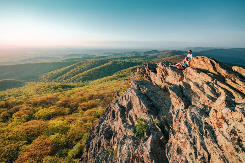
I cross the parkway and pursue the trail into a mature forest studded by towering hickories and occasional monster oaks. The farm tableaus inspire thoughts of a wilder era—when the clap of pounding hooves signaled visitors, unimaginable blazes of stars tore the skies open each night, and the people who called these mountains home lived and died by the land itself.
The path abruptly steepens en route to a massive greenstone outcropping that juts from the mountain like the wrecked and jagged hull of some ancient Titanic. A careful scramble to the top yields a striking panorama of the Shenandoah Valley and distant Alleghany Mountains. I think of the first Europeans to confront these peaks, when herds of elk and bison thundered through an idyll of grasslands tended by indigenous tribes and the nights belonged to the wolves.
James River Face Wilderness, Milepost 63.7
The parkway drops slowly from the Amherst County highlands through a corridor of huddled woods into the James River Gorge—where the landscape erupts suddenly into the distance like a sunrise cutting all at once through ink-black darkness. I breeze across the Harry Flood Byrd Memorial Bridge, basking in idyllic views of the 400-foot-wide river flowing east through a nine-mile gauntlet of towering, wooded hillsides backed by the humped, distant ridgeline of 3,600-foot North Mountain.
I make a post-eye-candy U-turn and park by the James River Visitor Center. A one-mile out-and-back on the Canal Trail lets me cross the waterway via a nifty pedestrian bridge and contemplate an eastward panorama of grassy floodplains and bankside sycamore forests flanked by the jagged, far-off peaks of Rocky and Fleming Mountain. From there, the trail follows the remains of a man-made canal path to a rectangular, 1800s riverside lock crafted from huge and beautiful slabs of hand-chiseled granite. It was part of an insanely ambitious—and costly—shipping system masterminded by George Washington that used motorless wood boats to ferry tobacco and other goods to Richmond and the greater Chesapeake Bay. I watch the dark water flow while a train whistle moans in the silent distance.
Apple Orchard Falls, Milepost 76.5
I pull into the 3,400-foot Sunset Field Overlook, shoulder my day pack, and pause to take in the sights. A tumult of undulating greenery rolls downhill through countless knobby hollows toward the checkered farms of the bucolic Arnold Valley and a wall of hazy, cobalt mountains that staircase higher and higher into the cloud-swept horizon.
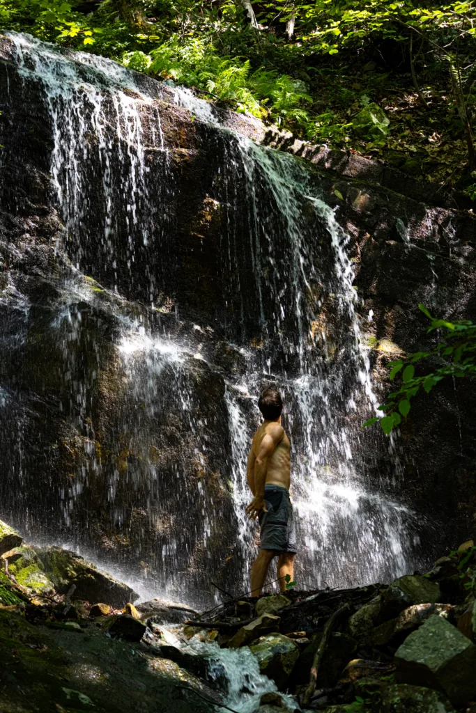
I eventually pull myself away and follow the 1.5-mile trail into a stand of adolescent hardwoods below the lot. The sound of my breath mixes with the windswept susurrus of green leaves, the sing-song chirrup of warblers, and the playful rustle of squirrels in the underbrush. Soon enough, I arrive at a thin, swift-running stream that caroms through a maze of small rock shelves and mossy boulders. Tributaries seep in here and there, and the waterway widens as I descend through strange groves of rhododendron that seem plucked from the pages of Grimms’ fairy tales. The slope steepens, and a series of switchbacks and wooden stairways slash down the rocky escarpment toward the effervescent crash of falling water.
I round a bend, and there it is: a towering silvery onrush that bursts from a shelved break in the trees to cascade down a cliffy, 200-foot stack of car-sized boulders. A wooden walkway crosses the creek and invites me to ponder the quiet, violent beauty of the falls from all angles.
Peaks of Otter, Milepost 86
Thirty-five-year veteran parkway ranger and wildlife biologist Tom Davis has explored “nearly every square foot of the park,” he tells me and feels “pretty confident calling this area Virginia’s crown jewel.”
The famed, 3,000-plus-foot triumvirate of Sharp Top, Flat Top, and Harkening Hill bowls around a small, picturesque valley encircling a 24-acre lake and yielding a first impression that feels like I’ve stepped into a Bill Turner painting. That sense deepens as I park by the tiny cabin and general store at the foot of Sharp Top Mountain. A shuttle carries visitors with mobility issues to the 3,875-foot summit, but I’m here for the walk.
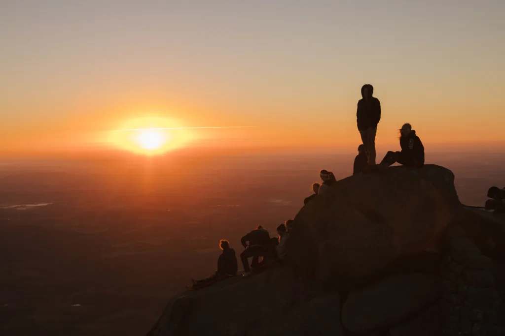
The 1.5-mile path cuts a long spiral around the mountain, then zigzags its way up stone stairways that weave through sequences of hulking cliffs and make you marvel at the effort it must have taken to build them. The route steepens as I go and brings a tough 1,300 feet of elevation gain. But the hard work pays off at a stone viewing platform that connects a football-field-sized stack of gargantuan rock slabs and outcroppings that look to have been puzzled together by some mythic giant. I lean against a stone wall and lose myself in an 80-mile Piedmont panorama that planes gently eastward toward the inevitable Atlantic.
Smart View Recreation Area, Milepost 154
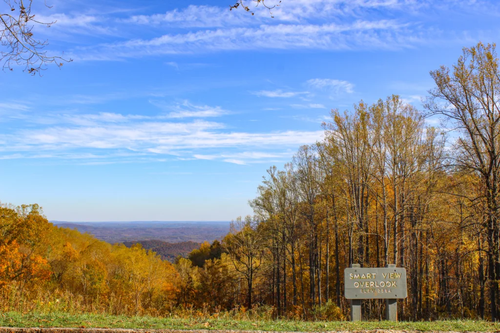
Original Parkway landscape architect Stanley Abbott visited what was then a long mountaintop pasture perched above the surrounding tree line in 1937. He was awestruck by its 2,600-foot vistas of wooded, creek-etched gorges that streamed like a still-framed tide through the rural Franklin County foothills. The impression inspired him to include the spot in the Parkway’s inaugural quintet of designated recreation areas.
The 500-acre stopover opened in 1940 and now holds a 72-site campground with two hot-water bathhouses, RV hookups, and a large pavilion. But I’m here to explore a 2.6-mile loop trail that passes through what Davis calls “an extremely rare stand of old growth forest anchored by massive and crazily gnarled oak trees.”
The trek begins with a wind-trembled wildflower meadow ablaze with chest-high goldenrod and the elegant, colorful sweep of butterflies. It dips and climbs through variegated hillside forests bisected by springs that gurgle downhill to feed Brogan and Roaring Run Branch. I bushwack into the grove about halfway in, not far from an abandoned 18th-century cabin that stands like an eerie memorial to a forgotten pioneer who once called this place home. The big trees stretch their huge, knotty limbs through the canopy in a wild, frozen dance that makes me think of many-armed Vishnu. I hunker down against a trunk, slip out of time, and bear witness to the glorious magic of songbirds materializing one by one by one.
Floyd Country Store, Milepost 165
The hip and funky, 500-person mountain town of Floyd unfolds across a picturesque 2,500-foot plateau about six miles from the Parkway. Its historic downtown boasts an array of revitalized mid-19th and turn-of-the-century homes and buildings populated with inns, eateries, boutique shops, businesses, and cafes. But the Floyd Country Store is the community’s beating heart.
Visit on a Thursday evening, and you’ll likely hear the twangy wail of a telecaster, pedal steel, and backing band chugging through train-rhythm honkytonk. The tunes radiate from a 1900s Appalachian-vernacular stick building with big, lead glass windows and an antique double door that opens into a scene that reads like a Norman Rockwell take on old-school Austin, Texas.
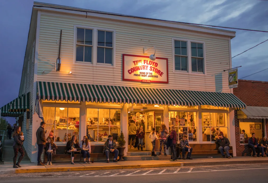
To one side is a ’50s-style soda fountain and general store replete with barrels of hard candy, homemade baked goods, and an antique cash register. The other holds a dancefloor crowded with an intergenerational mix of small kids, tie-dyed teens, outdoorsy forty-somethings, and Western-Wear-bedecked seniors. They spin and sway before a raised stage reminiscent of a front porch—where legendary country guitarist cum Galax transplant, Redd Volkaert, baritones through Ray Price’s 1956 barroom hit, “Crazy Arms.”
Fridays bring famed bluegrass jam sessions that’ve been held for 40 years straight. Saturdays and Sundays offer intimate performances from regional up-and-comers and roots-leaning stars like Sierra Hull or Bela Fleck.
Mabry Mill, Milepost 176
The working historic watermill is among the parkway’s most iconic and visually represented cultural treasures—but to me, videos and photographs never quite capture the landmark’s full essence.
I park in a rear field near some RVs and a small, wooded creek that funnels into a curious, wooden impoundment backed by a log-flume-style chute. The latter planes through the trees for hundreds of yards atop progressively taller lumber trellises that feel part and parcel with the landscape. I follow the structure as it banks past a grassy, village-esque complex that holds a turn-of-the-century cabin, smithy shop, springhouse, horse stable, whiskey still, and more. The aqueduct leads to a 14-foot waterwheel that powers machinery for the fabled 1910 grist, lumber, and textiles mill.
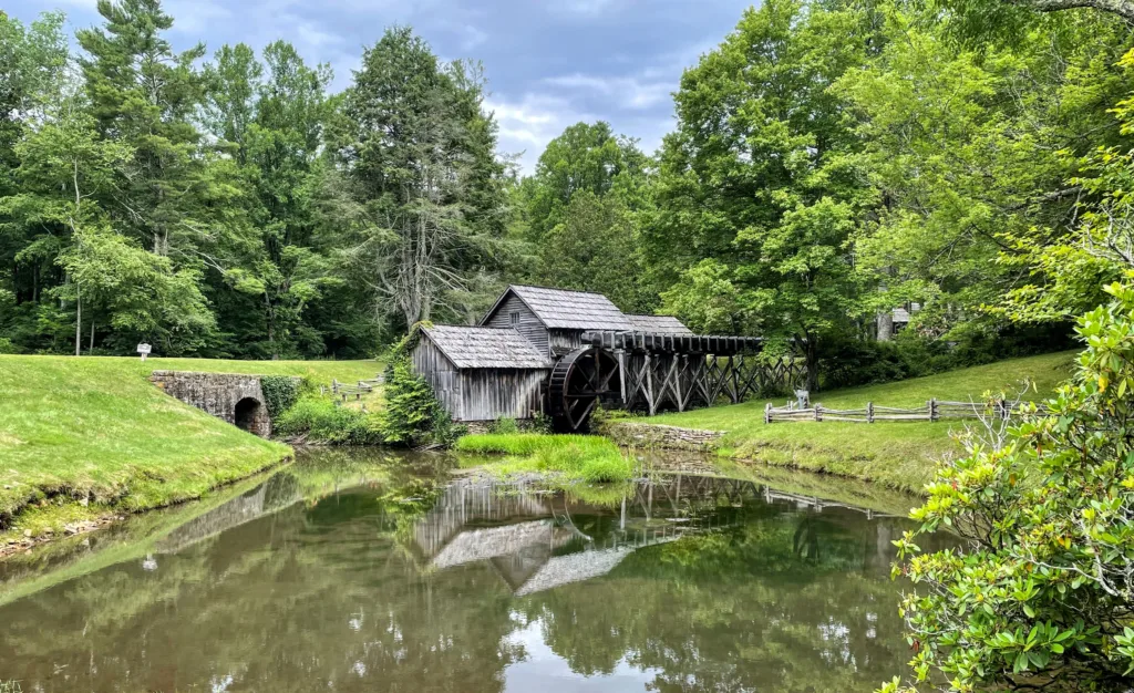
I loop around to the parkway shoulder and take in the scene: The weathered, wood-sided building sits atop a stacked stone foundation that doubles as a partial wall for a reedy, Monet-esque overflow pond flanked by a split-rail fence and high woods. You can hear the thrum of gears and machinery as interpreters demonstrate how corn was once stoneground into a delicious, utilitarian meal. This spot was the former industrial backbone of the surrounding Meadows of Dan community. I close my eyes and try to imagine the simple urgencies of that existence—but a car whirs by and I find myself suddenly laughing.
Feature image by Kristina Lowe. This article originally appeared in the April 2026 issue.