Once a vital transportation route between Richmond and the mountainous reaches of western Virginia, the old Staunton-Parkersburg Turnpike today roughly follows U.S. 250, U.S. 33 and Route 47, but in some ways is little changed.
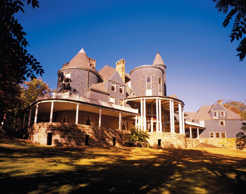
Halliehurst Hall at Davis and Elkins College, built in 1890 by Senator Stephen B. Elkins.

Holly Ann Normand ices a cake at Bittersweet Bakery, owned by Sheila Ishee, 120 South Lewis St. in Staunton.
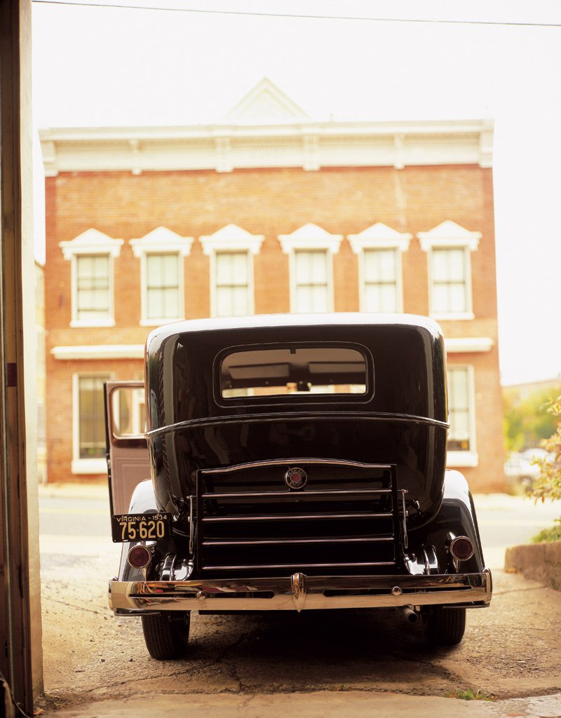
A 1934 Packard restored by A. J. Markunas at the Motor Car Co., 110 S. Lewis St., Staunton.
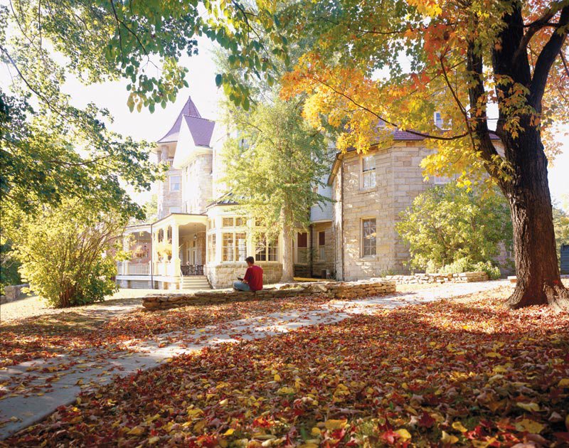
Graceland Inn, former summer home of Sen. Henry Gassaway Davis, at Davis and Elkins College in Elkins, West Virginia.

Mechanic Danny Sagets at Hermitage Exxon in Bartow, West Virginia.
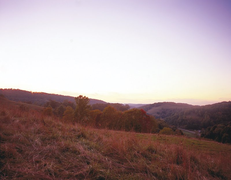
Sunset near Burnt House, West Virginia.
Photography by Robb Scharetg
It is one of those dusky autumn afternoons when the sky holds that dense, deep blue of gathering chill. Before me is a vista of five long ridges, the first two rich with the amber and golden hues of fall, fading softly into the blue horizon of the Alleghenies. I stand atop the spine of Shenandoah Mountain, buffeted by the westward winds of Highland County, the old trenches of long-ago war cutting through the woods to my right. Here in April 1862, Confederate troops under command of General Edward Johnson built high-elevation fortifications just prior to the Battle of McDowell and the opening of Stonewall Jackson’s famed Valley Campaign. Just steps away, automobiles ply the same route that horses, wagons, civilians and soldiers traversed more than a century-and-a-half ago.
Today Route 250 holds its place as one of the southern Appalachians’ most scenic U.S. highways as it rambles over and around countless mountain slopes, through long expanses of dense national forest land, along low river valleys and into the heart of quiet little mountain towns. Those who travel slowly and carefully along this winding highway between Staunton, Virginia, and Elkins, West Virginia, and then on its sister byways of 33 and 47 to Parkersburg, will find the remnants of long-ago lives and war and many days’ worth of exploration in the still wild mountains of a forgotten Virginia.
Building and Traveling the Old Pike
The Staunton-Parkersburg Turnpike was built as part of a national movement for improved roads, particularly into the nation’s backcountry areas. After much lobbying from the citizens of western Virginia, the General Assembly finally approved the construction of a turnpike designed to link Richmond with the Old Dominion’s western frontier and open up the mountains for settlement and commerce. Virginia’s chief engineer for the Board of Public Works, Claudius Crozet, began laying out the road in 1824, following the natural contours of the land and, often, old Indian paths. “The road had to take a route they could handle with the technology of the time,” says Ruth Brinker, former coordinator of West Virginia’s Staunton-Parkersburg Turnpike Alliance.
It took contractors more than two decades to build the road and all its bridges. “For its time, the Turnpike was an engineering feat,” says Brinker. “And there are all kinds of stories along the Turnpike.”
Often these tales have to do with the Pike’s sometimes unusual routes through the Alleghenies. Carolyn Pohowsky, executive director of the Highland County Chamber of Commerce, points out the Turnpike’s passage through Hightown, Virginia, where it bypasses a much easier pass through the mountains to the south along today’s Rt. 84. The Hevener family, who still preside over the village of Hightown on a farm where the James and Potomac Rivers both have their origins, lobbied for the Pike to come through their village and past the family’s general store. “They were very prominent landowners,” says Pohowsky, who is a descendant of those early Heveners, “and they managed to cut a deal to get the Pike to come through Hightown.” Today, visitors along U.S. 250 can still see the old Hevener General Store and Dividing Waters Farm, which has been in the Hevener family for seven generations.
Traversing some of the state’s steepest mountains and crossing numerous rivers and streams, the road was finally completed in 1849. Its primary bridge builder was Lemuel Chenoweth. Though not part of the Staunton-Parkersburg Pike, his covered bridge at Philippi, West Virginia, is still in use today. “If you can imagine crossing these mountains in horse and buggy,” says Brinker. “That was a serious stretch of road.”
The Turnpike was a toll road well into the 1890s, with toll houses situated at various points along the route, some of them still visible to this day, including the log toll house on the east side of Jack Mountain east of Monterey, where a replica toll gate still crosses the indentation of the original Pike. Tolls varied depending on what people were riding or driving along the Pike. A man on a horse paid about six cents at each toll gate, while a carriage might pay as much as 55 cents. The tolls were designed to pay for maintenance of the Turnpike, though with the frequency of mountain floods and washed-out bridges, tolls rarely covered the expense of upkeep, and by the time of the Civil War, many portions of the road were in severe disrepair.
Fighting Over the Western Highway: Civil War Comes to the Mountains
When the Civil War erupted in 1861, the Staunton-Parkersburg Turnpike represented a key transportation route between Richmond and the Confederacy’s western frontier in Virginia. It also controlled access to the Baltimore and Ohio Railroad.
While the numerous Civil War sites still visible along U.S. 250 may not have the appearance of the monument-strewn battlefields at Gettysburg or Vicksburg, the landscape along this lonely winding highway was nevertheless strategically significant and host to some of the war’s first fighting. The scattered battles in these mountains ultimately determined the 1863 division of Virginia into two states and opened the way for Stonewall Jackson’s renowned Valley Campaign.
“If you just look at the calendar for 1861,” says John Hutchinson, program manager for resource protection with the Shenandoah Valley Battlefields Foundation (SVBF), “you see that whole series of battles they were fighting eastward along the Turnpike as a fight to determine what part of Virginia the Union would maintain control over.”
The first land battle of the Civil War occurred at Philippi, where troops under the soon-to-be-famous General George B. McClellan began the Mountain Campaign of 1861, planning to protect access to the B & O and to protect pro-union citizens of western Virginia. On June 3, Federal troops launched a surprise attack against Confederate forces stationed in this small village, driving them south in a nearly bloodless clash toward Huttonsville.
South of Philippi, outside the historic village of Beverly, visitors can still walk the grounds and explore the remnant fortifications of the July 11, 1861 Battle of Rich Mountain. The old Pike, now a gravel road, climbs up Rich Mountain to a preserved battlefield, where Confederates under Colonel Robert Garnett fortified two mountain passes straddling the Staunton-Parkersburg Turnpike. Garnett had 1,300 men to McClellan’s more than 5,000 and was routed after McClellan launched a surprise attack. Two weeks later, in the wake of the disastrous Federal defeat at Manassas, President Abraham Lincoln summoned the winning McClellan to Washington to assume command of the Army of the Potomac.
In the late summer of 1861, both Confederates and Federals began to dig in along the Staunton-Parkersburg Turnpike, the Federals establishing fortifications at Cheat Summit, west of Bartow, the Confederates at Camp Allegheny, which now straddles the Virginia-West Virginia line. Both sites remain intact and appear much as they would have during the harsh winter of 1861-62. Camp Allegheny, more than 4,000 feet in elevation, was held by 1,200 men under Edward Johnson and represented a nearly impregnable position, something Union General Robert Milroy discovered on December 13, when he led an assault on the fort and was summarily driven back down the mountain.
Troops at these two high-elevation forts suffered from wind exposure, cold, measles, pneumonia and treacherous supply routes up mountain roads. First Lt. Shepherd Green Pryor of the 12th Georgia Infantry wrote home from Camp Allegheny in 1861, “I want this fight whipped out here before winter [or] it will be so cold that we cannot stand it.”
Pryor was not to have his wish. Confederates remained at Camp Allegheny until April. George P. Morton, serving with the 31st Virginia, said of his winter on Allegheny Mountain, “Between the measles and the worst climate I have ever seen, I am still dragging out a kind of miserable existence. … It rains in torrents nearly every day, and when not raining, we are in the midst of clouds through which one can’t see fifty yards.”
Standing on the open mountain summit today, visitors can appreciate how soldiers here and at Cheat Summit must have suffered, as the wind whips across the desolate slopes.
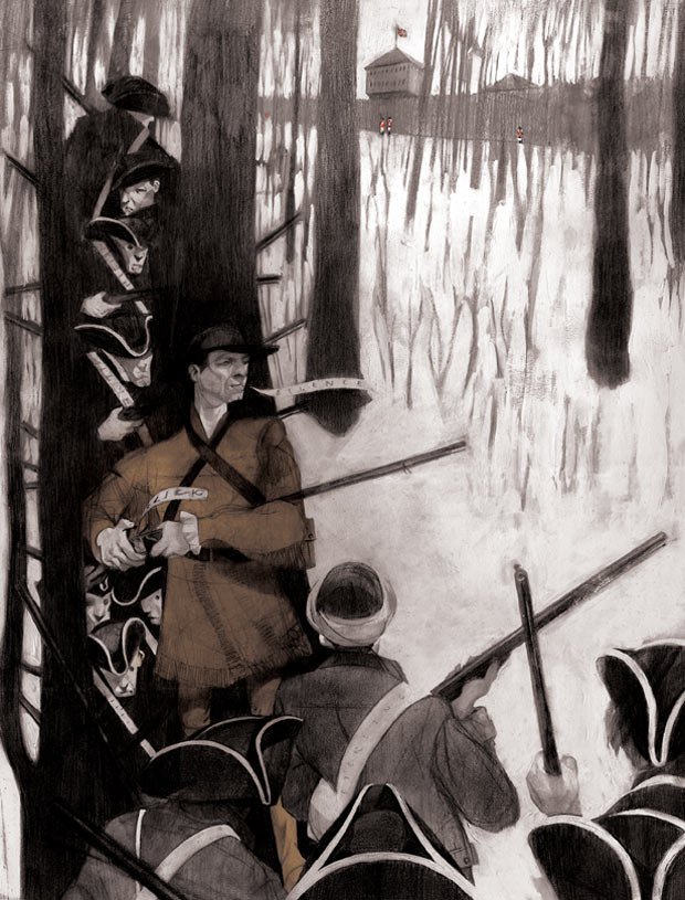
After abandoning Camp Allegheny, Johnson’s troops moved east through Monterey and McDowell, Virginia, and occupied a new position atop Shenandoah Mountain. Confederates constructed breast-high trenches here in April 1862, in an effort to defend the city of Staunton and the Turnpike from invasion by Union forces from the west.
Remains of these trenches can still be seen on both the north and south side of Route 250 at the Highland County line. Johnson and his men abandoned the breastworks here at the end of April, following General Stonewall Jackson’s defeat at Winchester, and joined Jackson at Staunton, a major Confederate supply depot that provided both rail service to Richmond and access to the Valley Pike, now Route 11.
A few days later, Confederates marched back toward Shenandoah Mountain as Jackson sought to stem Union advances from the west. The result was the Battle of McDowell, on May 8, 1862. Here, Confederate forces positioned on Sitlington Hill above McDowell fended off a Union attack under Generals Robert Milroy and Robert Schenck. The Confederates drove the Federals back through the village and chased them almost all the way to Franklin. It was a hard-won victory, the Confederates suffering 498 casualties to the Federals’ 256. “When Jackson won,” says SVBF’s Hutchinson, “it settled the issue of where the state line would be that we have today between Virginia and West Virginia.” Many historians also consider the Battle of McDowell the opening salvo of Jackson’s successful Valley Campaign of 1862.
Turnpike Brings Industry to the Mountains
With the close of the Civil War, prosperity came quickly to the mountains. Rich with timber and coal, West Virginia in particular began to attract the attention of entrepreneurs and industrialists, and the Turnpike provided access to the state’s seemingly endless supply of natural resources.
In the 1880s, railroads began to open the wilderness further, providing access to coal and vast stands of virgin timber. Many towns grew up just because of the railroads, including Elkins, which now houses a visitor center in its old railroad terminal.
But lumbering and, later, strip mining began to take their toll on West Virginia, resulting in regular forest fires and floods. By 1911, Congress, recognizing the impact of the wholesale destruction of the nation’s forests, passed the Weeks Law in an effort to protect the country’s watersheds. Out of this came the Monongahela National Forest, established in 1915, with an initial purchase of 7,200 acres in Tucker County, West Virginia.
Gradually, more land came under the care of the Monongahela, and the process of reforestation began. Today, the Monangahela National Forest covers more than 900,000 acres, much of it along the Old Turnpike.
In the 1920s, as automobiles grew in popularity, paving of the nation’s roads began, including the Staunton-Parkersburg Turnpike. The new Pike stuck to the same course as the old, for the most part, though it bypassed a few areas of old road, including the routes that lead by Camp Allegheny and over Rich Mountain.
Today, with the coal boom long gone, the railroad heyday over and the construction of more direct, wider highways across the mountains, the old Pike doesn’t see the traffic it once did. “But that’s one reason the Pike has remained so pristine,” says Brinker. “Our road got bypassed by modern development, so it still looks much as it did 100 years ago.”
Info on the pike is available at spturnpike.org.


