
“Heaven and earth never agreed better to frame a place for man’s habitation.”
This is what British Capt. John Smith wrote when he encountered the lush offerings of nature inland from the Chesapeake Bay in the early 1600s. The powerful schools of Atlantic sturgeon in the rivers, the verdant, abundant marshes, the tall stands of wild rice—it all called to him.
Smith was enchanted. He came to love the clear waters, soaring riverside cliffs, and deep woods of Virginia, endeavoring to capture the richness of the land in his 1624 account, The Generall Historie of Virginia, New-England and the Summer Isles. “Here are mountains, hills, plaines, valleyes, rivers, and brookes, all running into a faire Bay, compassed but for the mouth, with fruitful and delightsome land,” he wrote.
In 1612, Smith became the first to map the Chesapeake accurately. His map, coupled with his many books documenting the fresh, fruitful American landscape, shaped the history of Virginia and Maryland throughout the 17th century, laying the foundation for all that followed.
None of the culture and history these states are known for today could have developed without the array of the tidal rivers throughout Virginia he described. They have become the basis for the present-day Capt. John Smith Chesapeake National Historic Trail, the first all-water route in the Park Service trail system.
His works mark a well-documented point in time to look back not only through four centuries, but also forward to everything that has happened since. Today, Capt. Smith’s Trail invites exploration—through its 1,800 miles and
connector trails—of the sprawling Chesapeake Bay estuary.
Smith’s map is accurate because he lived it wave by wave, mile by mile. He may have earned his commission as an infantry officer, but he became a skilled small-boat skipper in Virginia. Sailing and rowing the colony’s 30-foot shallop with his crew, he documented more than 3,000 nautical miles in 30 months while trading, conducting diplomacy, and exploring twice to the head of the Chesapeake into the Susquehanna,
Patapsco, Patuxent, Potomac, and Rappahannock. His missions took him to the scenic, sometimes treacherous Falls of the James and far up the Chickahominy, York, Mattaponi, and Pamunkey rivers.

Throughout his voyages, Smith took detailed notes. And after returning to England, he converted them into his Map of Virginia. Though his distances were off (it was the 1600s, after all), his map is uncannily accurate in laying out details in the meandering courses of the Chesapeake’s tidal rivers, which we still traverse today. It’s possible now, after 416 years, to run up the Rappahannock in a skiff to Wecuppom at Fones Cliffs and “walk the battlefield” by boat where Rappahannock archers and warriors ambushed Smith and his crew as they rowed up the river. It’s possible, and uncanny, to visit the sites Smith wrote of and see what’s there now after so much time. Much has changed, but it’s remarkable how many
of these woods and marshes are still wild and rich.
The indigenous people of Tidewater Virginia had already recognized the Chesapeake’s riches centuries before Smith’s arrival, foraging and trapping in the marshes as well as fishing and oystering. The land offered old-growth woodlands for hunting—deer, turkeys, squirrels, tortoises, and even snakes—and foraging, along with fertile soils for growing corn, beans, and squash. The natural beauty was ripe with high land for lookouts, freshwater springs, ravines for access to shorelines, and freshwater marshes, ideal for foraging edible plants such as arrow arum (“tuckahoe”) and wild rice. Fish filled the rivers—from white and yellow perch and white catfish to Atlantic sturgeon, striped bass, and river herring.
Smith’s map opened the Chesapeake to English colonization. By the late 1600s, many Indian town sites had English names and wharves that shipped tobacco to England. Just as Virginia’s tidal rivers served the indigenous people of the region, they then served as infrastructure for the colonists through the 18th century.

Fones Cliffs rise above the Rappahannock in Westmoreland
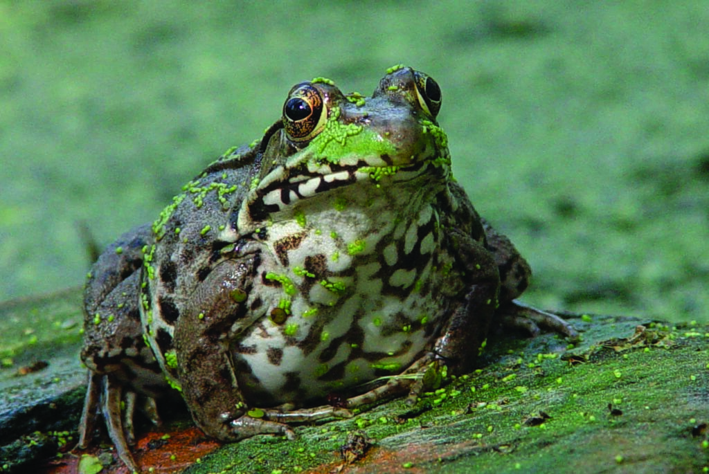
Green frogs are smaller than their close relative, the bullfrog.
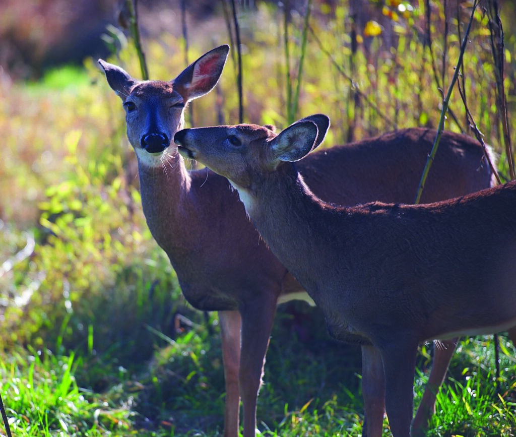
White-tailed deer can be found in various habitats across the Chesapeake Bay area.
Gradually but inexorably, ecological change was coming. As it had for three millennia, the Bay ecosystem served as the settling basin for a vast watershed largely covered by virgin forests. But as settlements grew, colonists cut timber, cleared land for tobacco, and mined—and paid scant attention to the toll it would inevitably take.
The damage came slowly at first. The rivers’ abundant fish continued to feed people, both subsistence anglers who were looking for panfish—white perch and brown bullheads—and large plantation communities that used new tools like long seine nets set by large skiffs rowed by powerful crews and drawn to shore by draft horses. During these times of plenty, fishermen sent their fresh catch to markets like Alexandria, and news of the rivers’ bounty attracted more industries to the water’s plentiful offerings.
As cities and towns blossomed around the Bay and its rivers, more unconscious pollution accumulated and persisted well into the 20th century. By the 1960s, it was obvious the Chesapeake’s “junk food” diet had caused its health to decline broadly. The land was suffering for value, not only for seafood and shipping but also for the rich wildlife and natural resource abundance that had once given the Bay Country the nickname “The Land of Pleasant Living.”
Since the late ’60s, the rushing river waters have seen a significant turnaround, restoration, and increasing appreciation. It’s evidenced by broad, vigorous cleanup partnerships and more public access to scenic land and waters with projects like Capt. Smith’s Chesapeake Trail.
As the rivers come to life again, we see miracles like breaching sturgeon, blooming August marshes, and waterways begging us to explore them in vessels ranging from paddlecraft and skiffs to trawlers. Capt. Smith’s Chesapeake Trail offers a gateway to learning thousands of years’ worth of the ways the natural resources of Virginia’s rivers have intertwined with humans.
There are so many stories from the past, along with the many good ones we are writing now every day along these hallowed waterways. Go see for yourself. NPS.gov
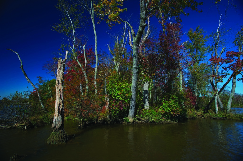
Black gum and red and silver maples at a tributary of the tidal Rappahannock River.

A lesser yellowlegs shorebird forages at a freshwater tidal tributary of the Rappahannock River.
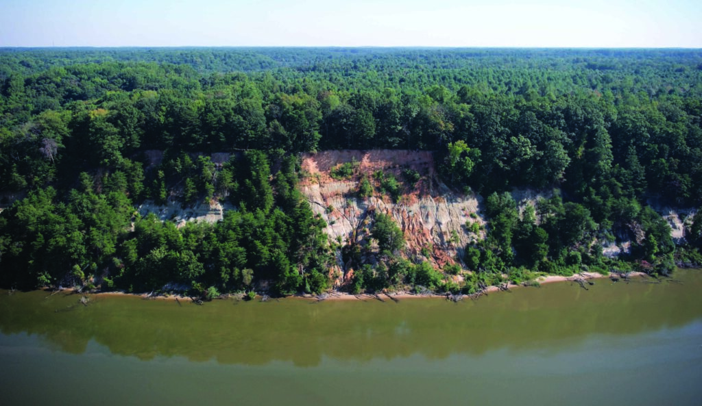
Fones Cliffs rise over 100 feet above the Rappahannock River.
This article originally appeared in the August 2024 issue.


